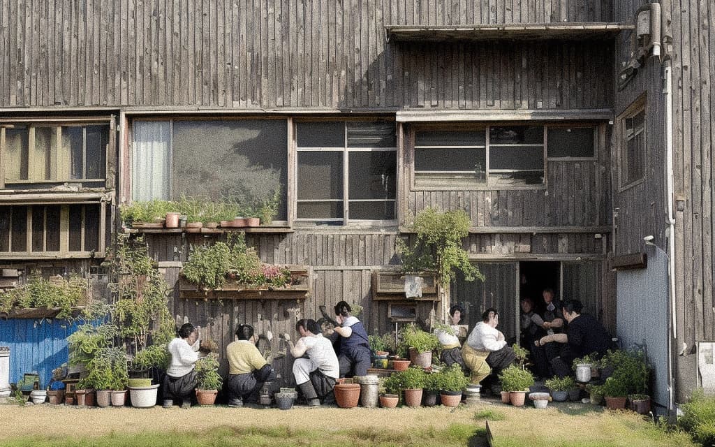
Generative AI Social Experiment #1
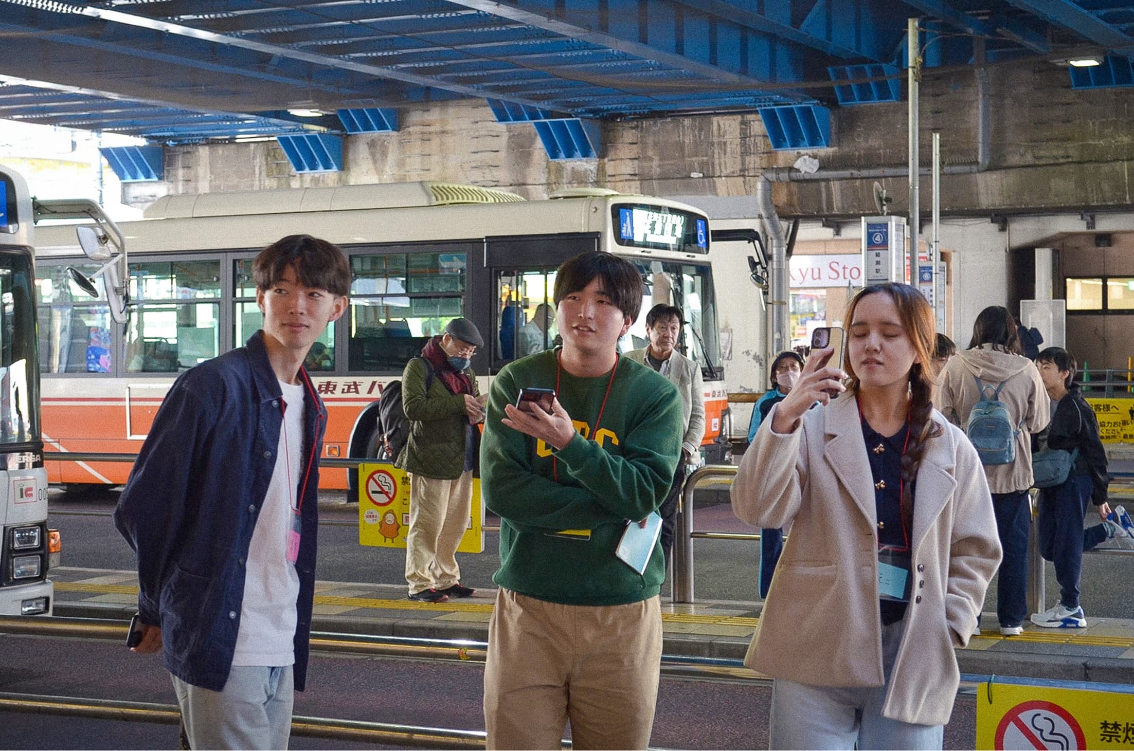
FIG.1
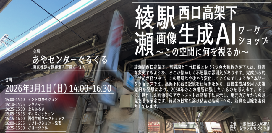
On Sunday, March 1, we held the “Image-Generating AI Workshop Under the Ayase Station West Exit Overpass: What Do You See in This Space?” at the Ayase Center Guruguru in Ayase, Adachi Ward.
Beneath the elevated tracks at Ayase Station’s West Exit—at the foot of two major transportation arteries, the Joban Line and the Chiyoda Line—there is a somewhat nostalgic and mysterious atmosphere that symbolizes Ayase. With nearly half a century having passed since its completion, how will this place change in the future?In this workshop, we’ll unravel the memories embedded beneath the elevated tracks and, through visual creativity using image-generating AI, consider what we’d like to preserve in this space by the year 2040.We plan to exhibit the resulting images and other outputs under the elevated tracks and solicit feedback from local residents. We look forward to fresh perspectives on this space beneath the tracks, which has become an integral part of daily life in Ayase.
綾瀬駅西口高架下 画像生成AIワークショップ ~この空間に何を視るか~
綾瀬駅西口高架下 画像生成AIワークショップ~この空間に何を視るか~綾瀬駅西口高架下、常磐線と千代田線という2つの大動脈の足下には、綾瀬を象徴するような、どこか懐かしく不思議な雰囲...
The place name “Ayase” derives from the Ayase River that flows through the town. The area surrounding the station is where the boundaries of Adachi and Katsushika wards intertwine, making it a highly densely populated area. The origins of this town lie in the fields and farmland that once spread across the floodplain of the “Old Sumida River,” which was formerly the main channel of the Tone and Arakawa Rivers. During the Edo period, new farmland was developed, and the area flourished as a logistics hub where agricultural products were transported to Edo by boat, and fertilizer was brought back.
The original Ayase Station was located about 200 meters west of its current position, near the underpass at the West Exit—the very site covered by this workshop. The station was established before World War II at the request of parents who wanted to ensure their children could commute to Tokyo Prefectural No. 11 Junior High School (now Tokyo Metropolitan Kohoku High School).
The current layout of Ayase Station was finalized in 1971. With the opening of the JR Chiyoda Line and the elevation of the Joban Line, the station was relocated to its present location. The land readjustment project carried out in conjunction with this was completed in 1977. Since then, the town’s basic structure has remained largely unchanged for approximately 50 years.
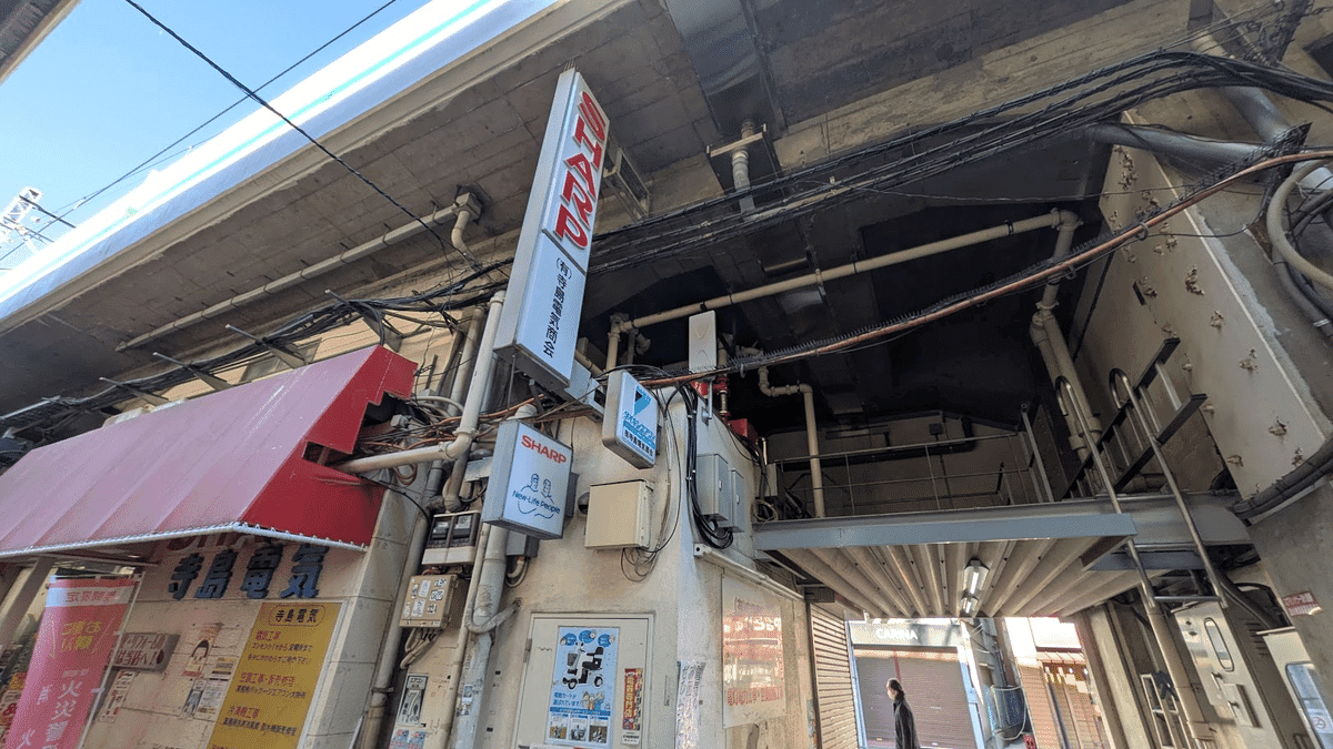
FIG.2
In particular, the area under the elevated tracks at the West Exit was constructed early on and, as such, differs from current building codes; it faces structural challenges because the railway pillars are integrated into the building walls. Given the aging of the structures, it is expected that these issues will be addressed during future reconstruction and renovation.
Furthermore, according to a survey of local residents, responses regarding the area under the elevated tracks included comments such as “the atmosphere is gloomy,” “it has a reputation for poor public safety,” and “it has a bad image.” While the shutters are closed during the day, the area transforms into a bar district at night, and there are voices expressing dissatisfaction with this.
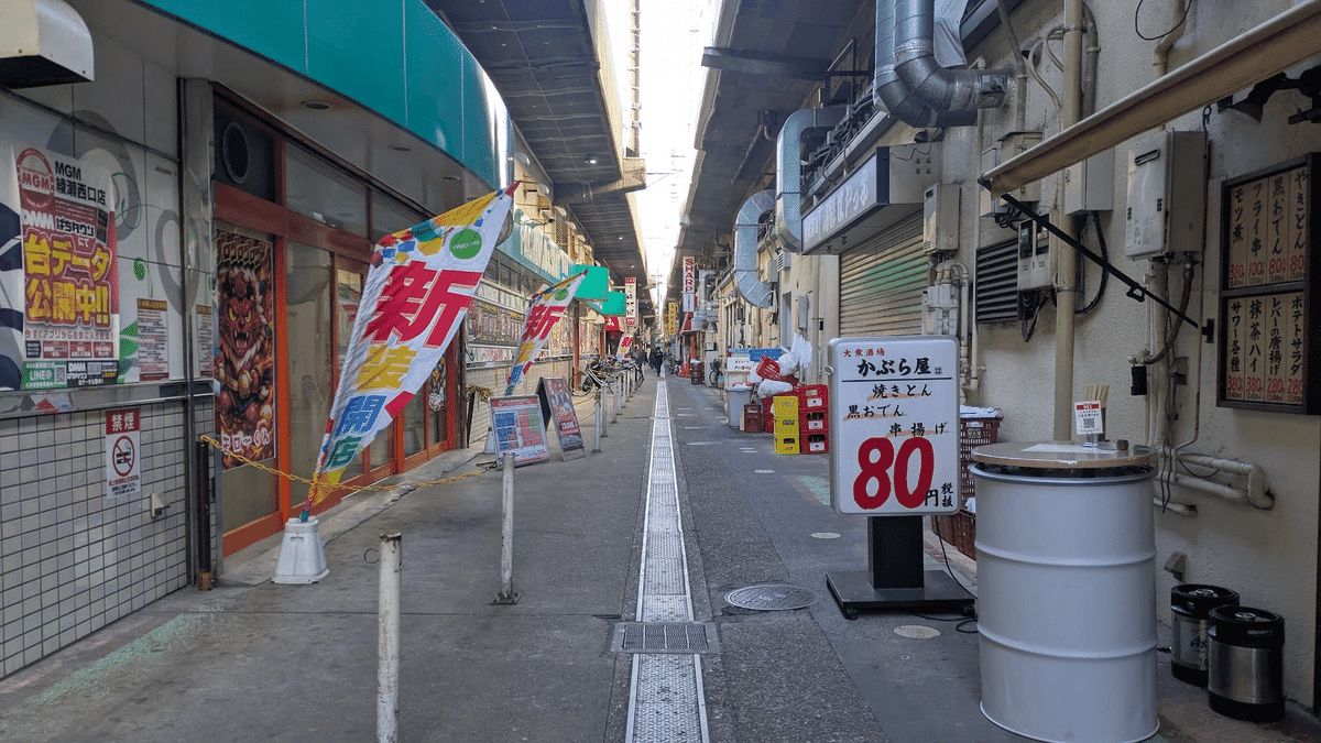
FIG.3
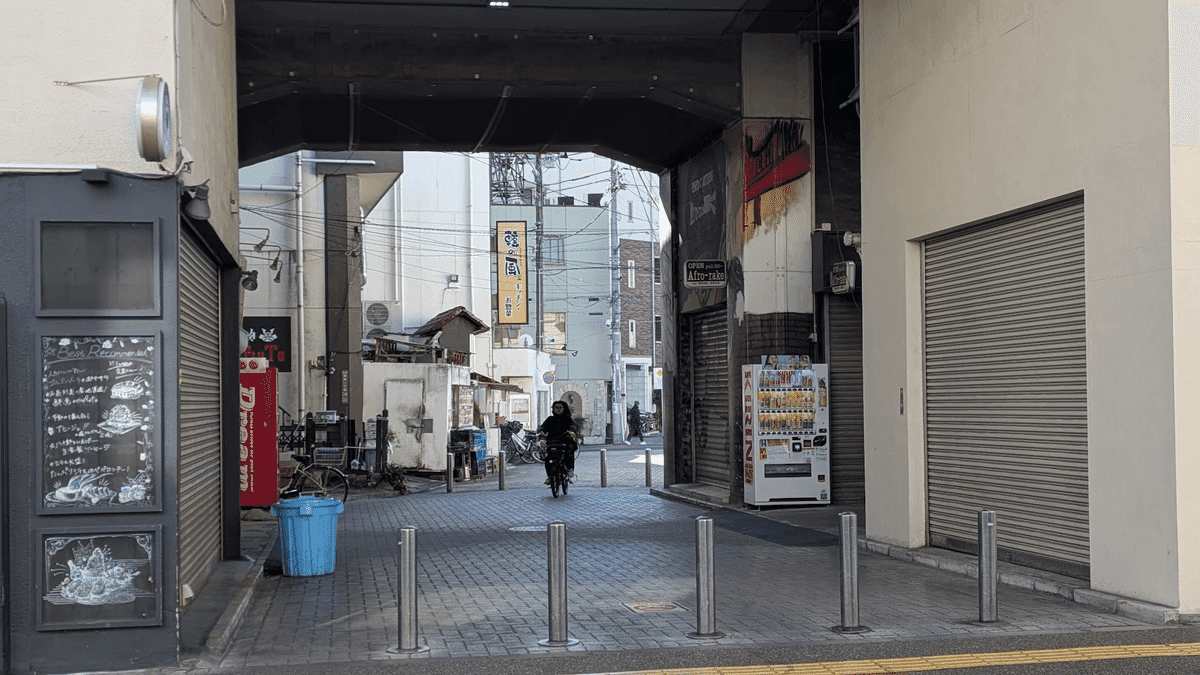
FIG.4
Against this backdrop, efforts have been made in recent years to revitalize the area under the elevated tracks and improve its image. “Aya Center Guruguru,” which we used as our venue for this event, is a community hub developed by the ward from a property that had stood vacant for several decades. Together with the café across the street, the creation of this bright, glass-enclosed space is gradually changing the area’s image.
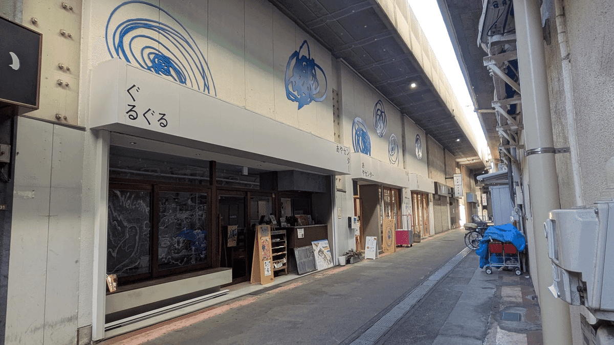
FIG.5
あやセンター ぐるぐる
あやセンター ぐるぐるのコンセプトは 「やってみたいを、やってみる」。 皆さんの「やってみたい」を応援する3つのエリアで構成されています。
Additionally, the Adachi Ward Community Development Division, which collaborated on this workshop, has organized events such as the “Ayase Station West Exit Underpass Mystery-Solving Walk.” The intention was to help people understand the true nature of the neighborhood—not by holding onto vague preconceptions like “it’s unsafe”—but by actually walking through the streets and observing the details for themselves.
綾瀬駅西口高架下謎解きウォーク
Every town likely has places like the area under the elevated tracks at Ayase Station’s West Exit—places that, while lacking historical or architectural significance, nonetheless contribute to the neighborhood’s unique character. However, to local residents, these areas are often taken for granted and tend to be perceived as lacking charm or appearing cluttered.In fact, it is true that, from the perspective of local residents, the area under the West Exit overpass raises concerns regarding public safety and other issues.
On the other hand, if such places are redeveloped or transformed into trendy spaces, it risks erasing the very essence of the town. It is crucial for local residents to first recognize the merits and charm of these places and then consider what to preserve and what to renew.
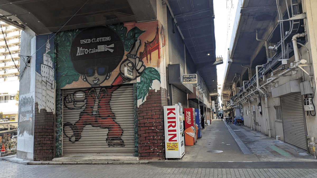
FIG.6
In this workshop, we aimed to uncover the charm of this place from the perspective of visitors, with young people who have never been to Ayase as our main target audience. By utilizing image-generating AI, we were able to visually communicate the abstract concept of a place’s charm.
The area’s appeal, as discovered through an outsider’s perspective, will be exhibited for local residents alongside the generated images and analysis data. This may also lead to proposals for railway operators.
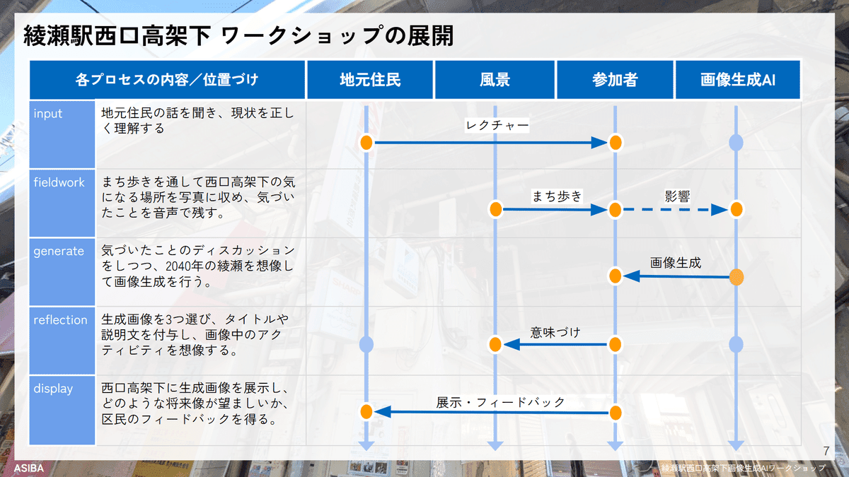
FIG.7
The core of this workshop was how to uncover and visualize the appeal of the area under the elevated tracks from the perspective of visitors unfamiliar with the town of Ayase. To achieve this, we designed the workshop around the following six steps:
① Input: Lecture
② Collection:
Fieldwork ③ Discussion: Group Discussion ④
Creation: Image Generation Workshop ⑤
Interpretation: Proposal Development ⑥
Sharing: Gallery Walk
While the detailed process will be described later, we focused on the following five points in designing the workshop:
Ensuring
an Appropriate Amount of Input First, we held a 15-minute lecture to learn about the city’s history and how local residents perceive the areas under the elevated tracks. It was crucial to control the amount of information appropriately: too little would result in only a superficial understanding, while too much would lead to participants being constrained by preconceptions.
Capturing Subconscious and Intuitive Charm While discoveries made
during fieldwork are converted into verbal information during discussions, the neighborhood also possesses a subconscious and intuitive charm that cannot be put into words.Working in groups, participants created their own image-generation AI models (LoRA) based on photographs taken during the fieldwork. By using these models to generate images, they reflected the charm that visitors unconsciously and intuitively perceived.
Balancing Subjectivity and Objectivity
In this workshop, we combined two types of LoRA models: “Subjective LoRA,” created on the spot by each group based on the images they took, and “Objective LoRA,” created in advance using photographs taken under the Nishiguchi Overpass.For the same prompt, we configured the system to output three images with varying ratios of “subjective Ayase-ness” to “objective Ayase-ness.”
The Strength
of LoRA The extent to which LoRA reflects what it has learned through additional training can be set in advance. In this session, we set LoRA to be stronger than usual, aiming to ensure the images did not stray too far from the spatial image of the area under the West Exit overpass while also encouraging more detailed input via the prompts.
The “Year 2040” Setting
For image generation, we used the prompt “The scenery I’d like to see under the elevated tracks in 2040.”The year 2030 is too close, leading to only realistic proposals, while 2050 is too far in the future, resulting in an overemphasis on technological elements like drones and sensors. We chose 2040 as a suitable future timeframe for visualizing what a city might look like.
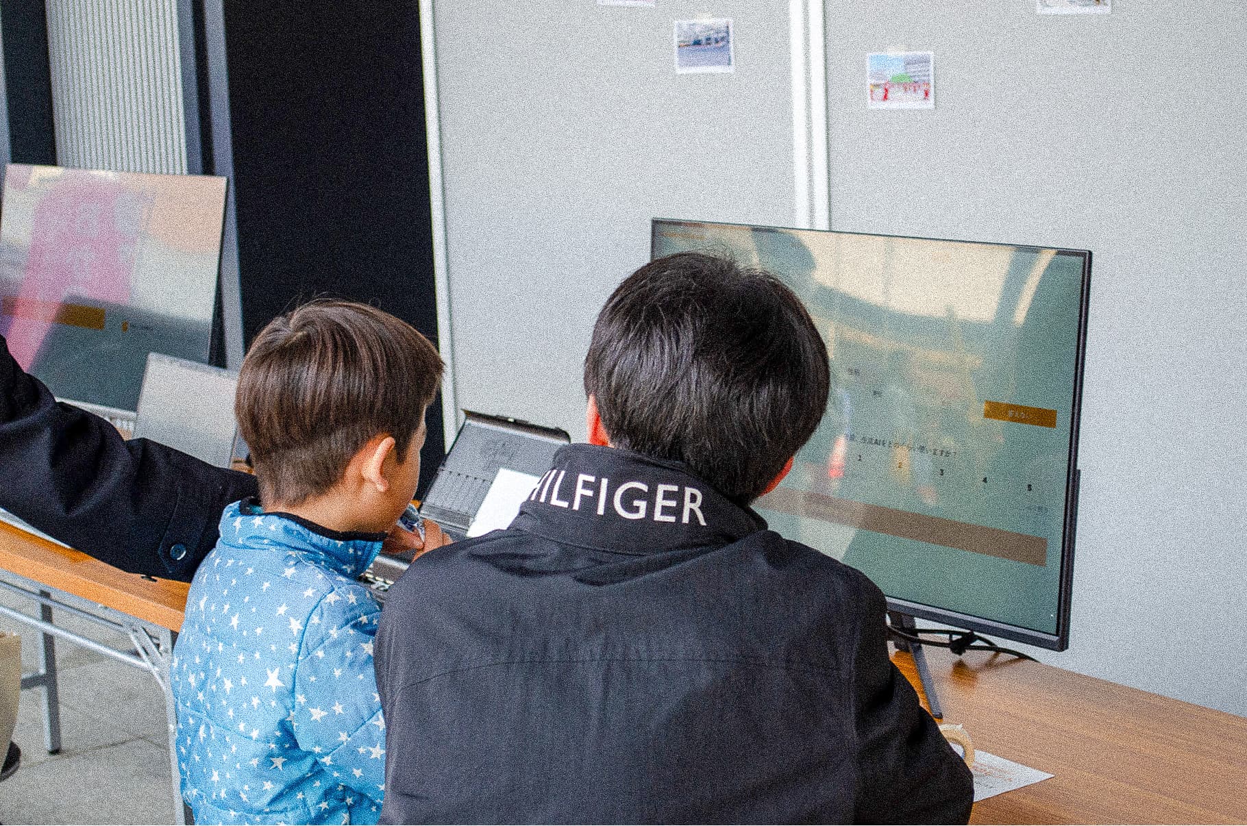
To seamlessly connect the five processes, we developed a web app for the workshop. Its key feature is that it is divided into individual steps, allowing participants to move back and forth between them.
STEP 1:
Upload photos taken during fieldwork
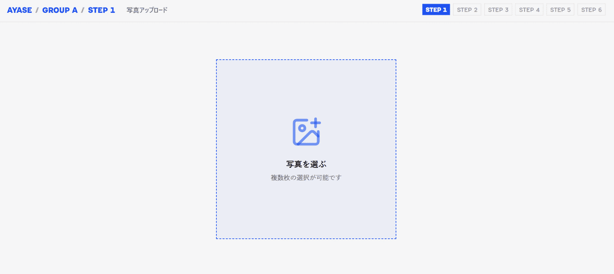
FIG.8
STEP 2:
Select just 10 photos that left a strong impression and record an audio description of the group discussion (text edits are also possible)
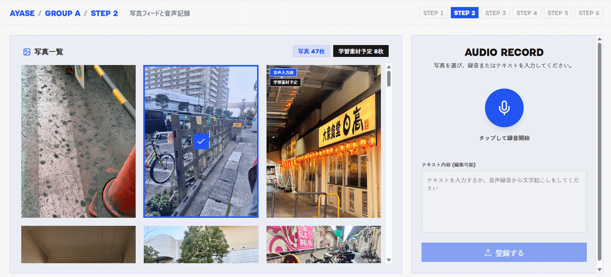
FIG.9
STEP 3:
Perform additional training on LoRA (an image-generation AI model) (takes 5–10 minutes to complete)
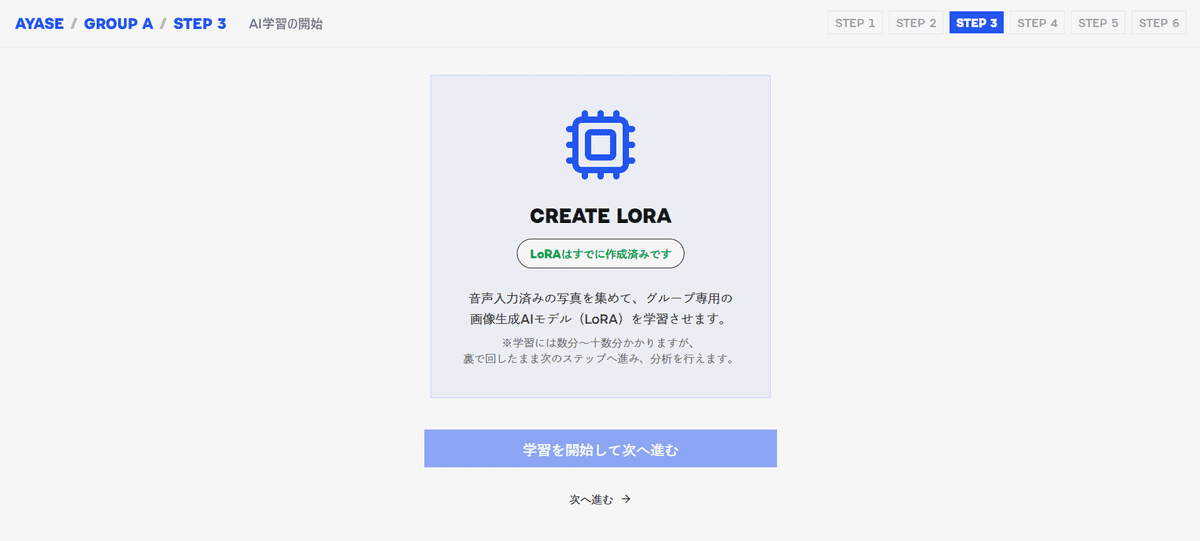
FIG.10
STEP 4:
Create a word cloud based on the audio recording from STEP 2, and add up to 10 keywords based on the discussion.
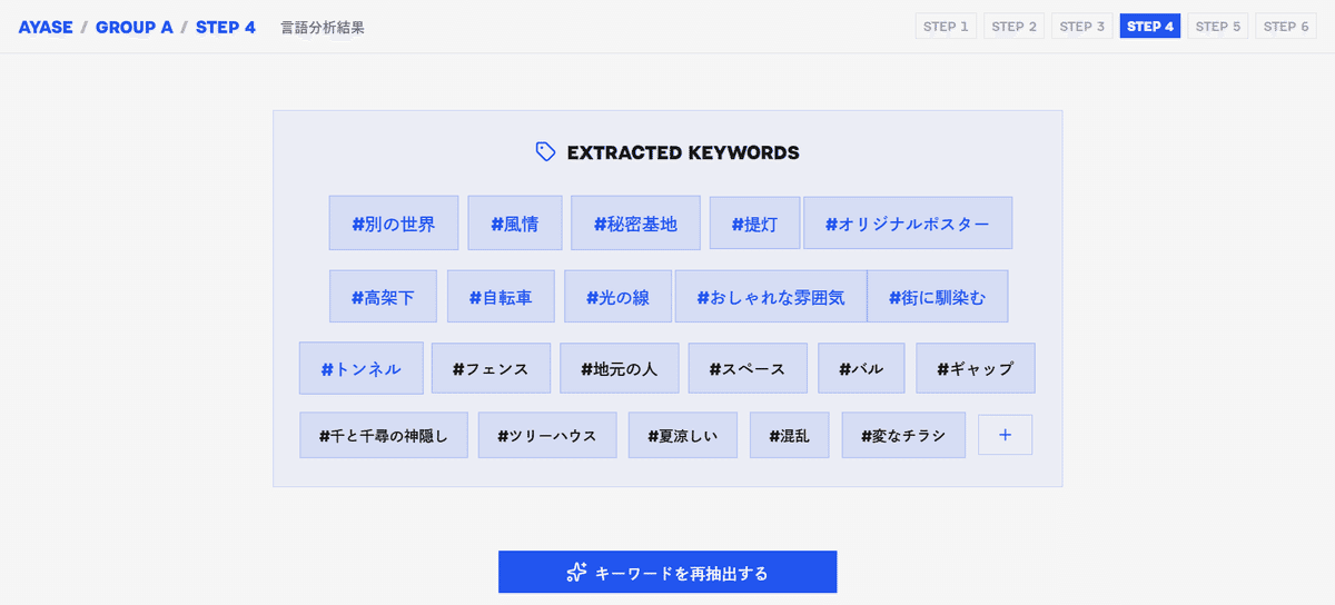
FIG.11
STEP 5:
Enter a prompt using the keyword list created in STEP 4 to generate “a scene under an elevated railway that you’d like to see in 2040.” The system is configured to generate three types of images, each blending Subjective LoRA and Objective LoRA in different ratios.
More subjective: Subjective 1.0 – Objective 0.3
; Intermediate: Subjective 0.8 – Objective 0.8; More
objective: Subjective 0.3 – Objective 1.0
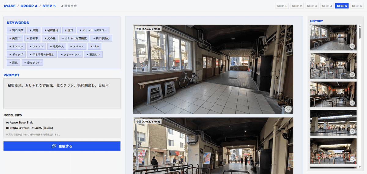
FIG.12
STEP 6:
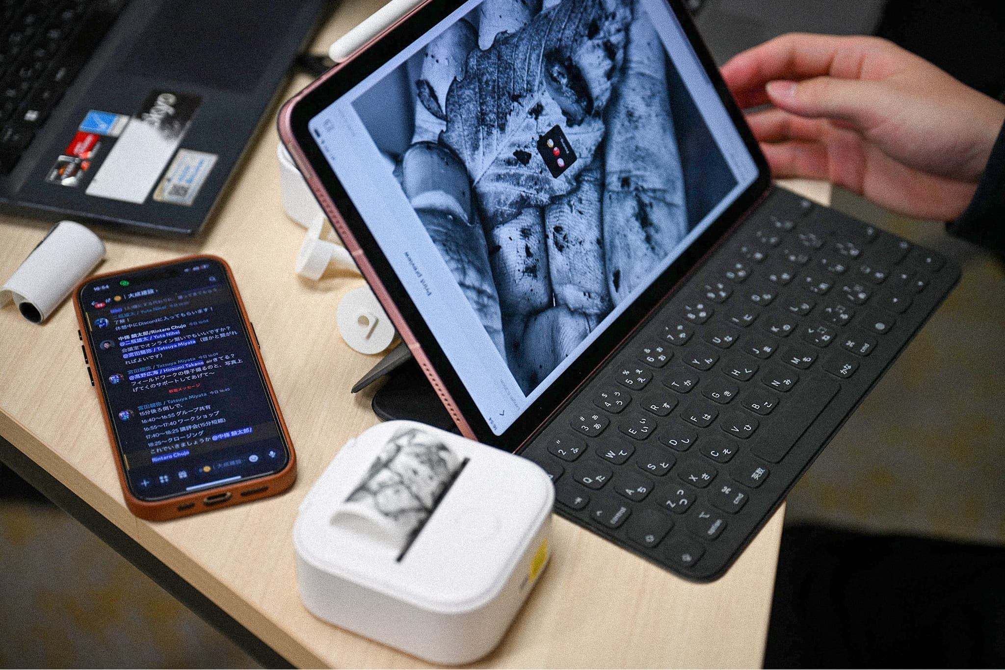
Select the best-looking images and print them on L-size paper.
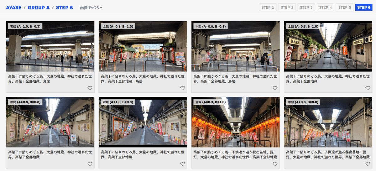
FIG.13
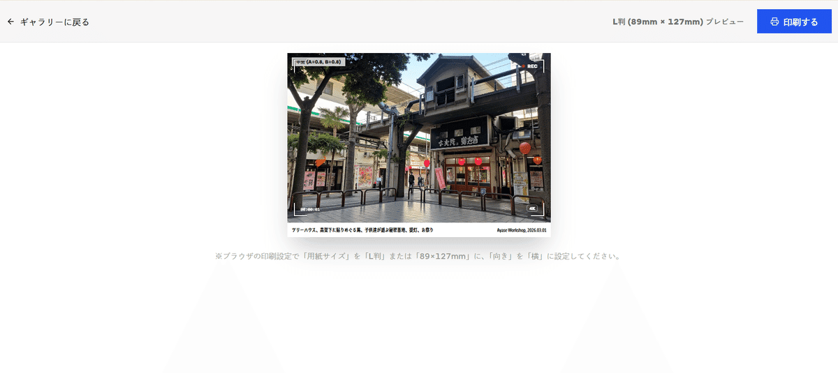
FIG.14
App Developed by Nozomu Sudo
Mr. Saito from the Adachi Ward Community Development Division gave a 15-minute lecture on the history of the Ayase area and the future of the space under the West Exit elevated tracks. Since many participants said it was their first time in Ayase, he concisely explained how Ayase has developed and why this distinctive space under the elevated tracks came to be.*Please refer to Chapter 1 for the details of the
lecture.
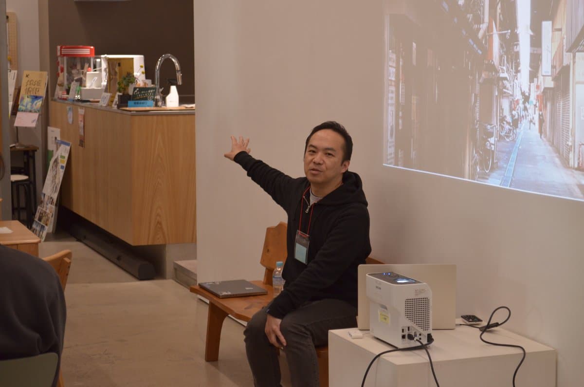
FIG.15
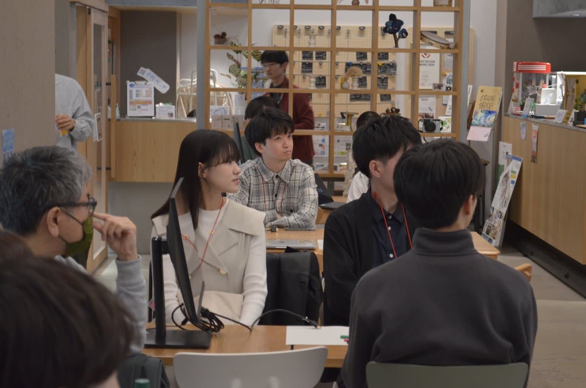
FIG.16
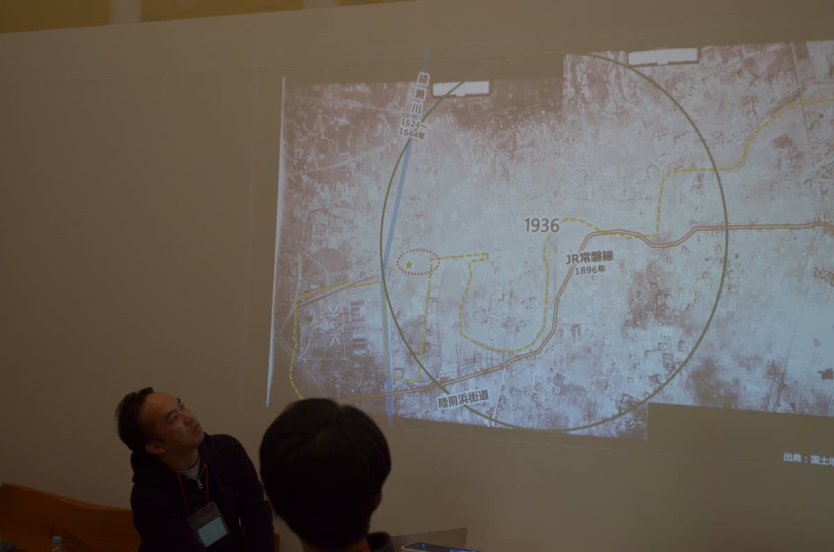
FIG.17
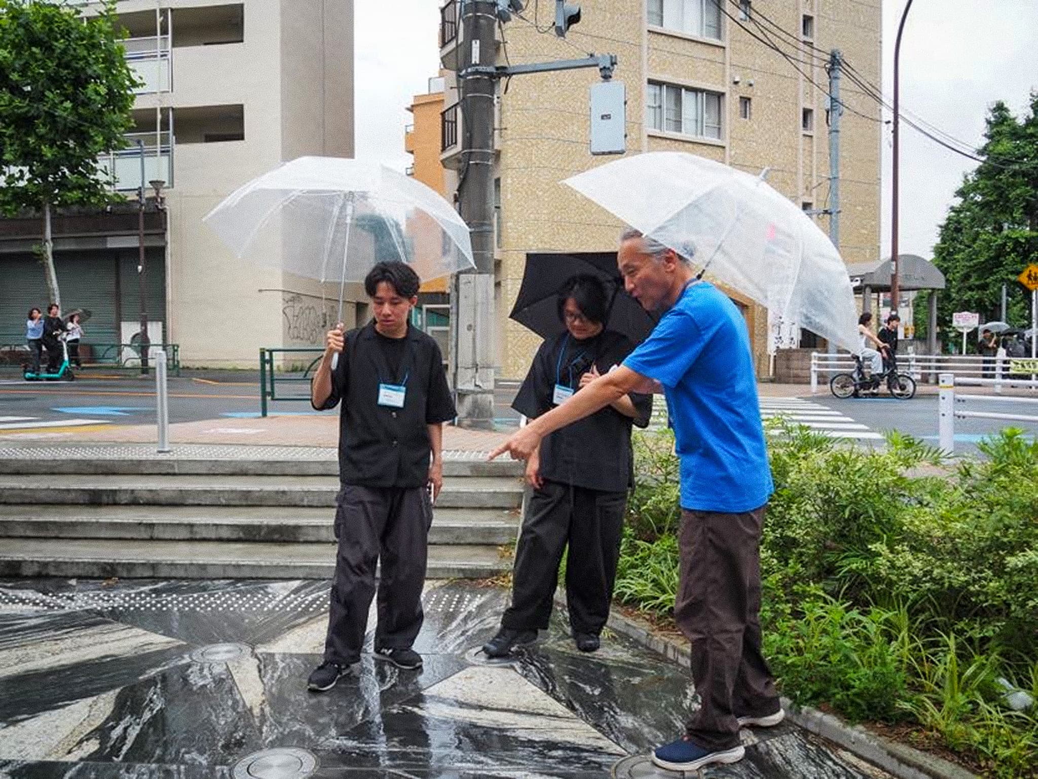
This was followed by a 25-minute fieldwork session. Focusing on the area under the West Exit elevated tracks, each participant was asked to take about 15–20 photos of things they found intriguing, things they found charming, and things they hoped would remain in this town in the future.
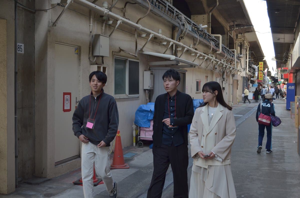
FIG.18
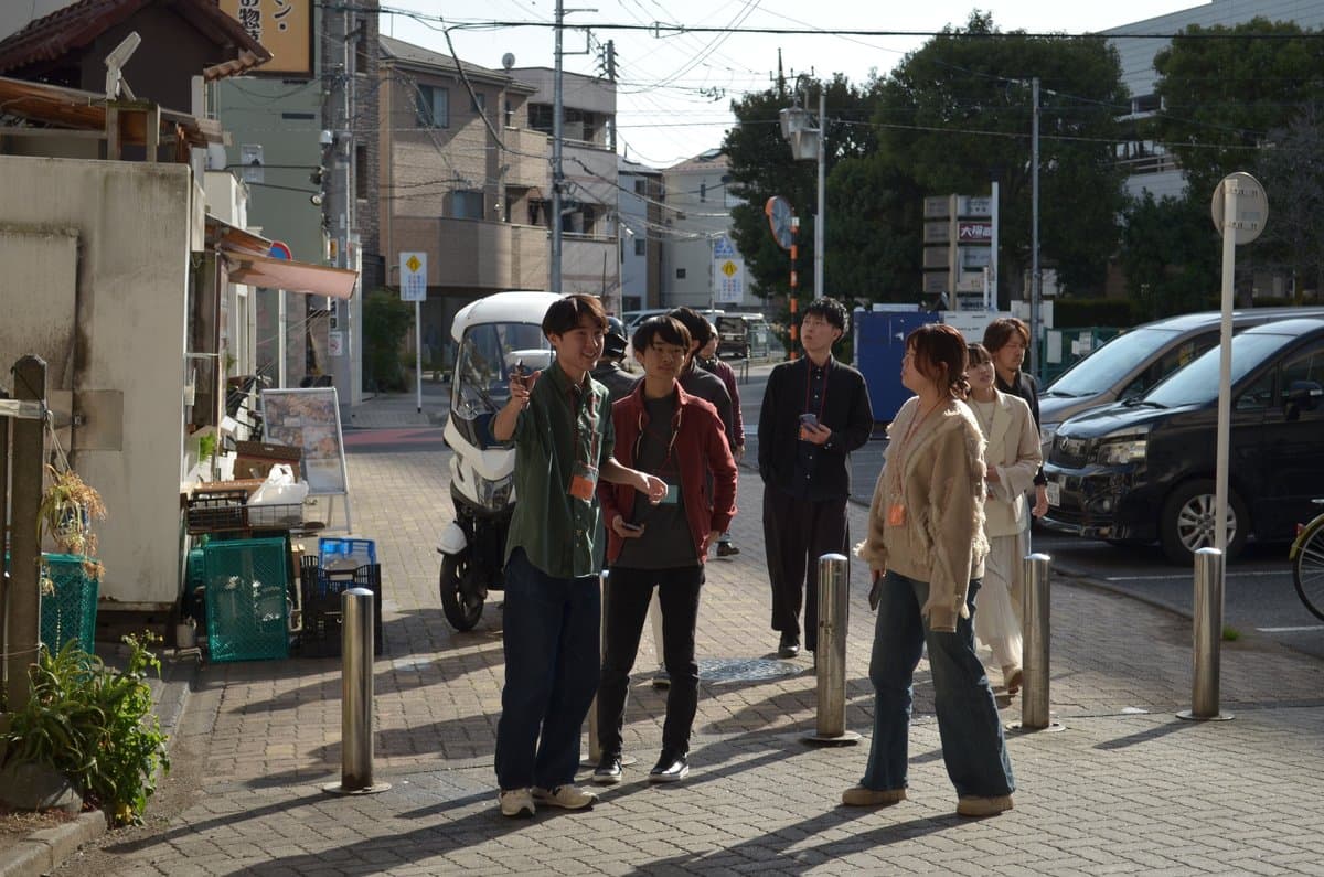
FIG.19
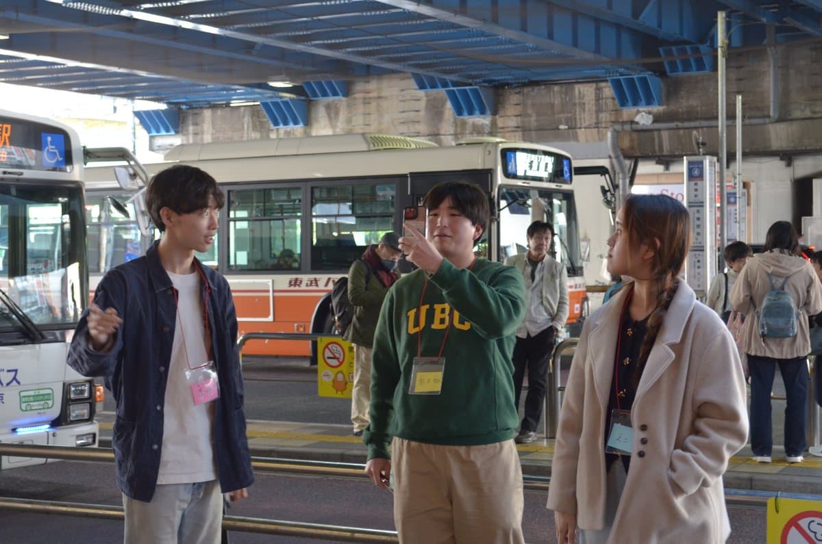
FIG.20
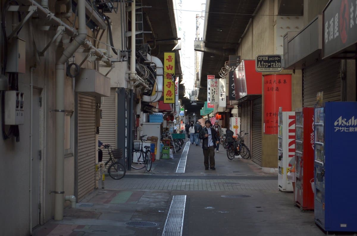
FIG.21
After completing Steps 1–3 of the workshop app, we held a discussion as preparation for image generation. Participants wrote as many ideas as possible on sticky notes regarding “What we’d like to see happen under this elevated railway by 2040.” After sharing these ideas within their groups, they selected 10 interesting ideas and added them as keywords to the app’s word cloud.
*On the day of the event, we swapped the order of Steps 1–3 and the discussion to address technical issues with the app.
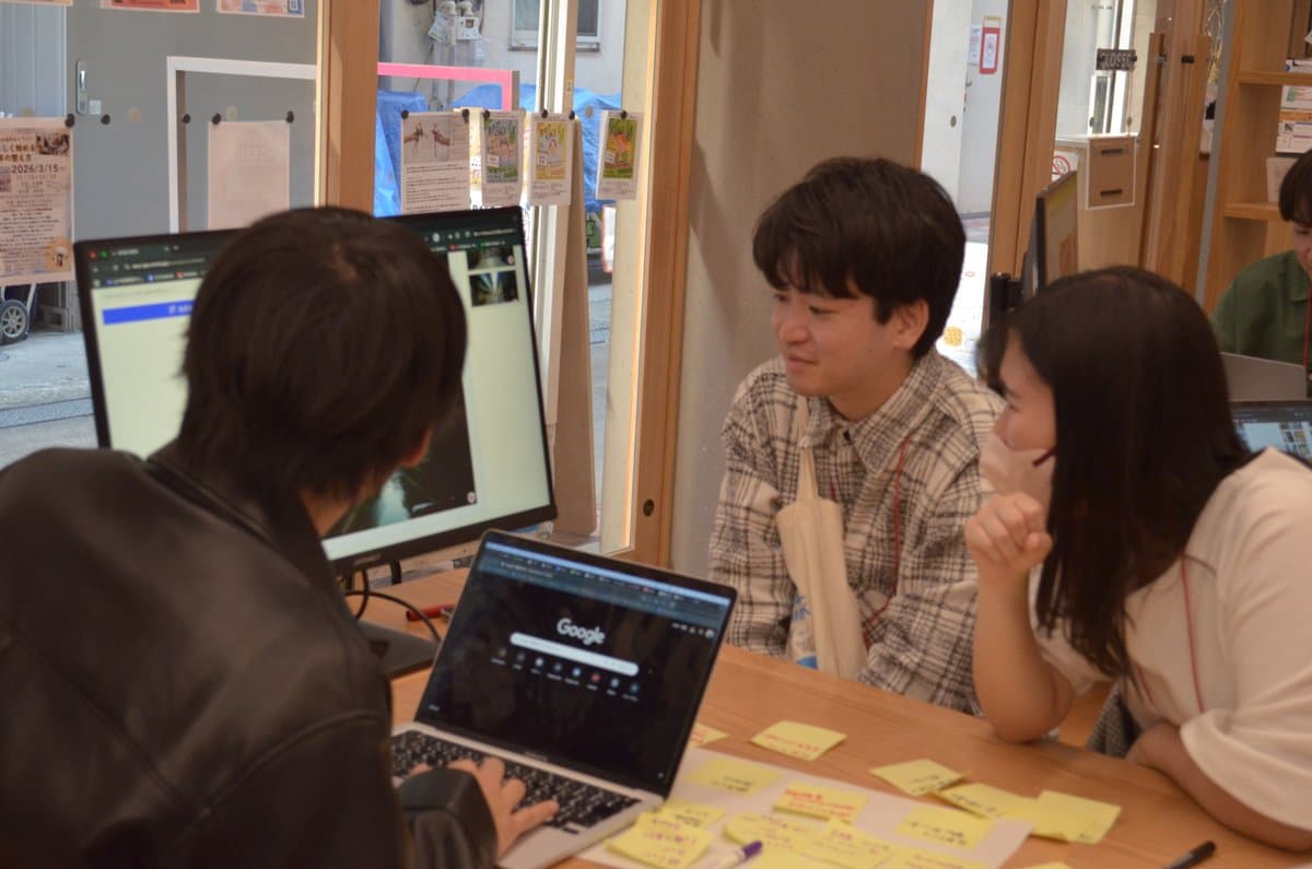
FIG.22
We entered prompts and began generating images of “scenes we’d like to see under the elevated tracks in 2040”! At first, we created prompts based on voice recordings and the list of keywords generated during the discussion. As we gradually got used to image generation, we experimented with different approaches and refined our prompts, eventually learning to produce images exactly as we envisioned.Images that turned out well were printed on the spot.
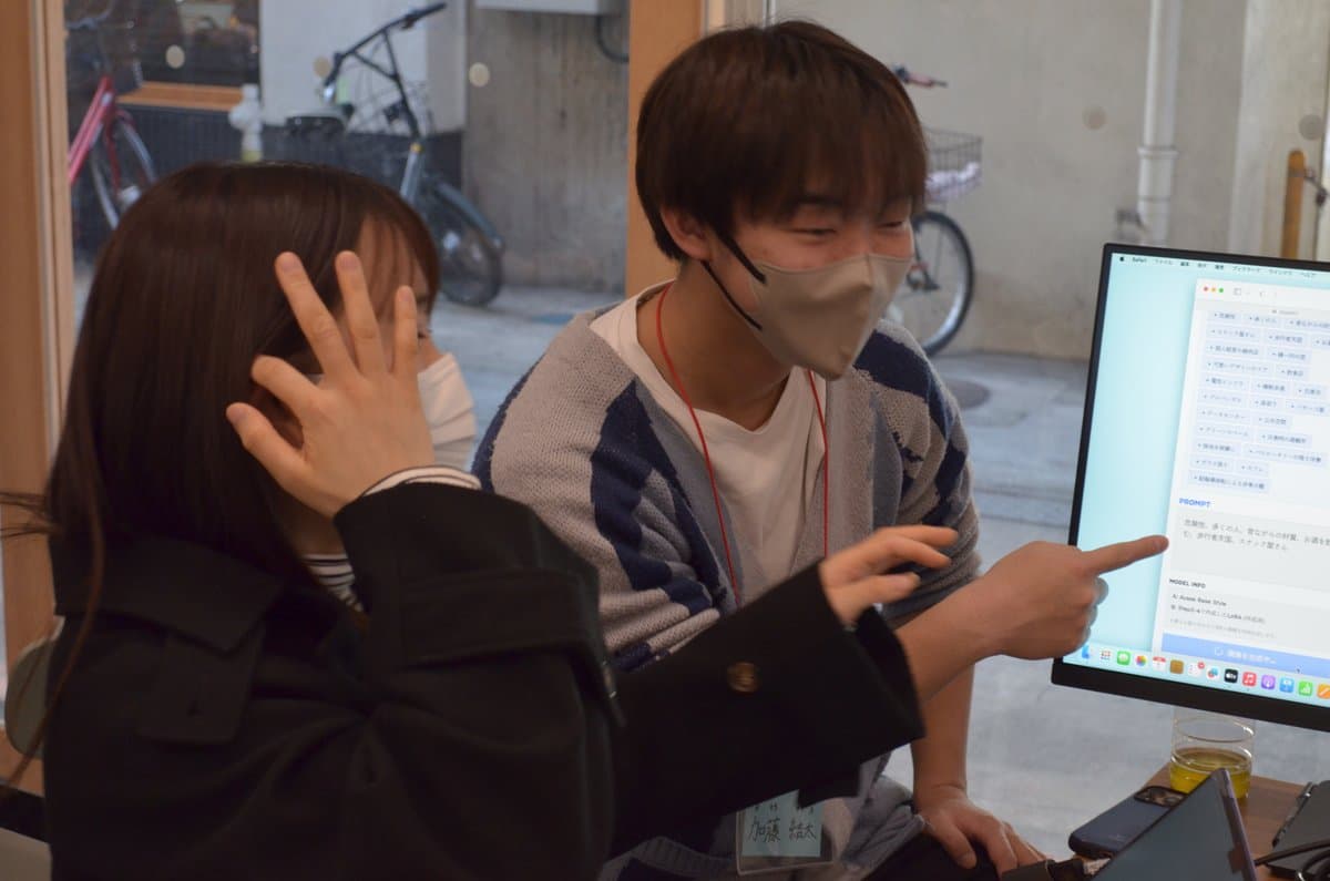
FIG.23
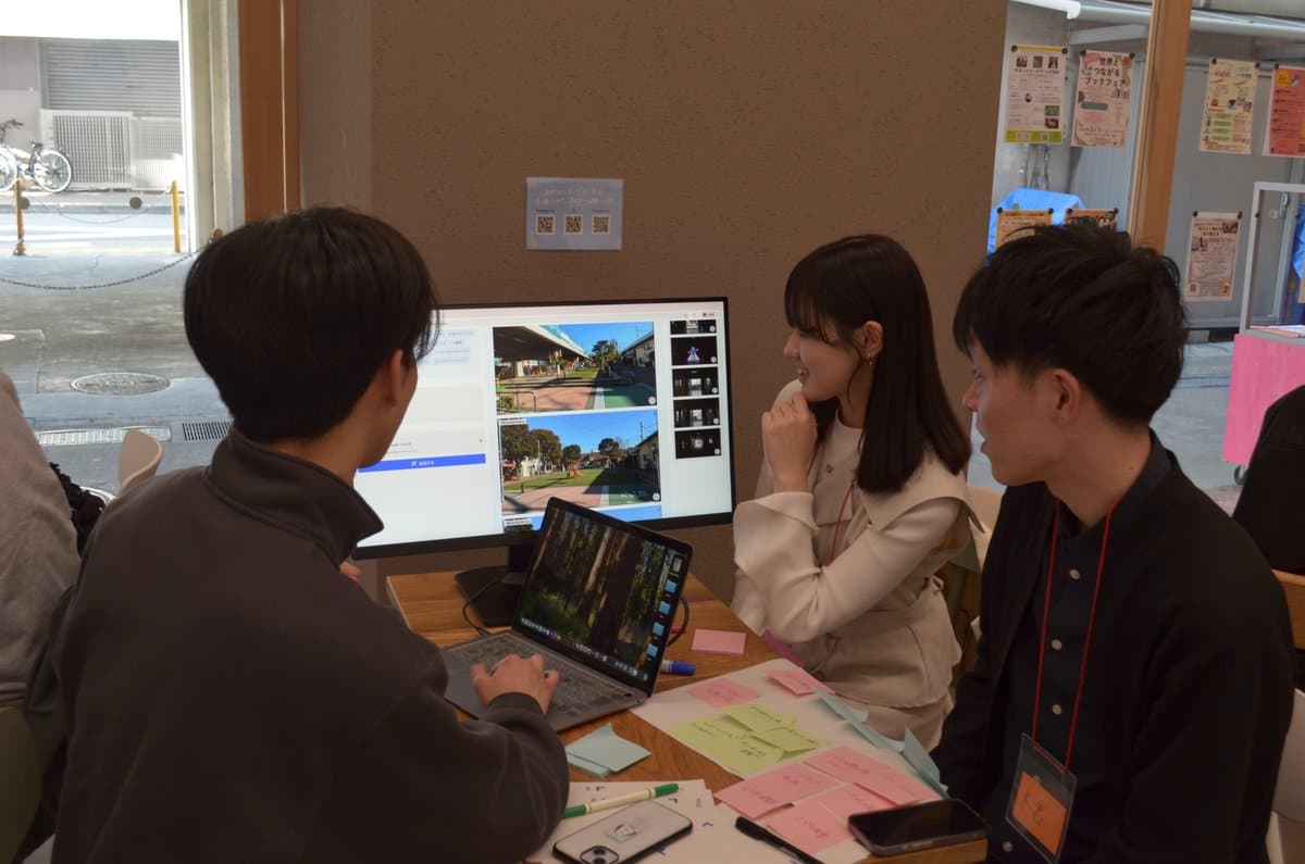
FIG.24
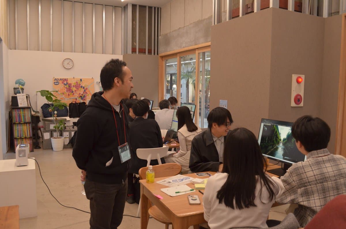
FIG.25
Participants selected one printed photo, pasted it onto a worksheet, and proposed a vision for the scenery under the elevated tracks at Ayase Station’s West Exit in 2040, along with a title.
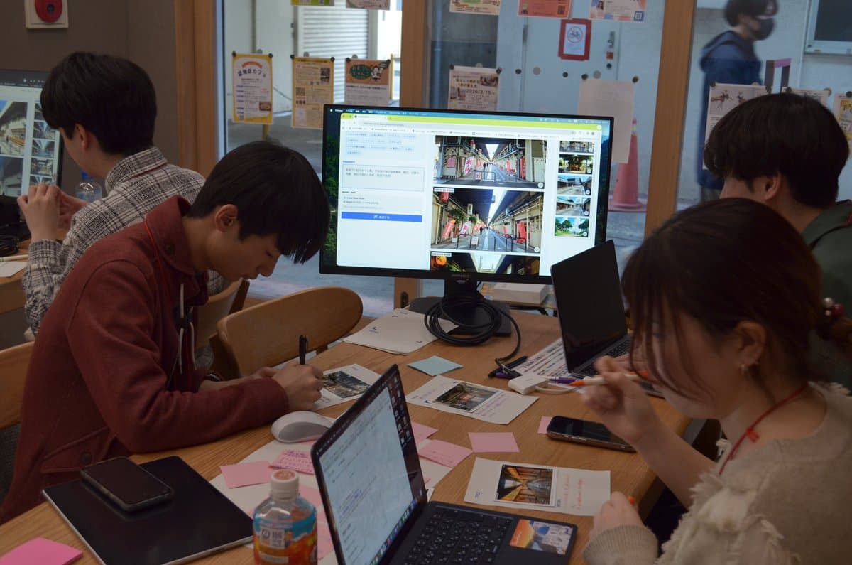
FIG.26
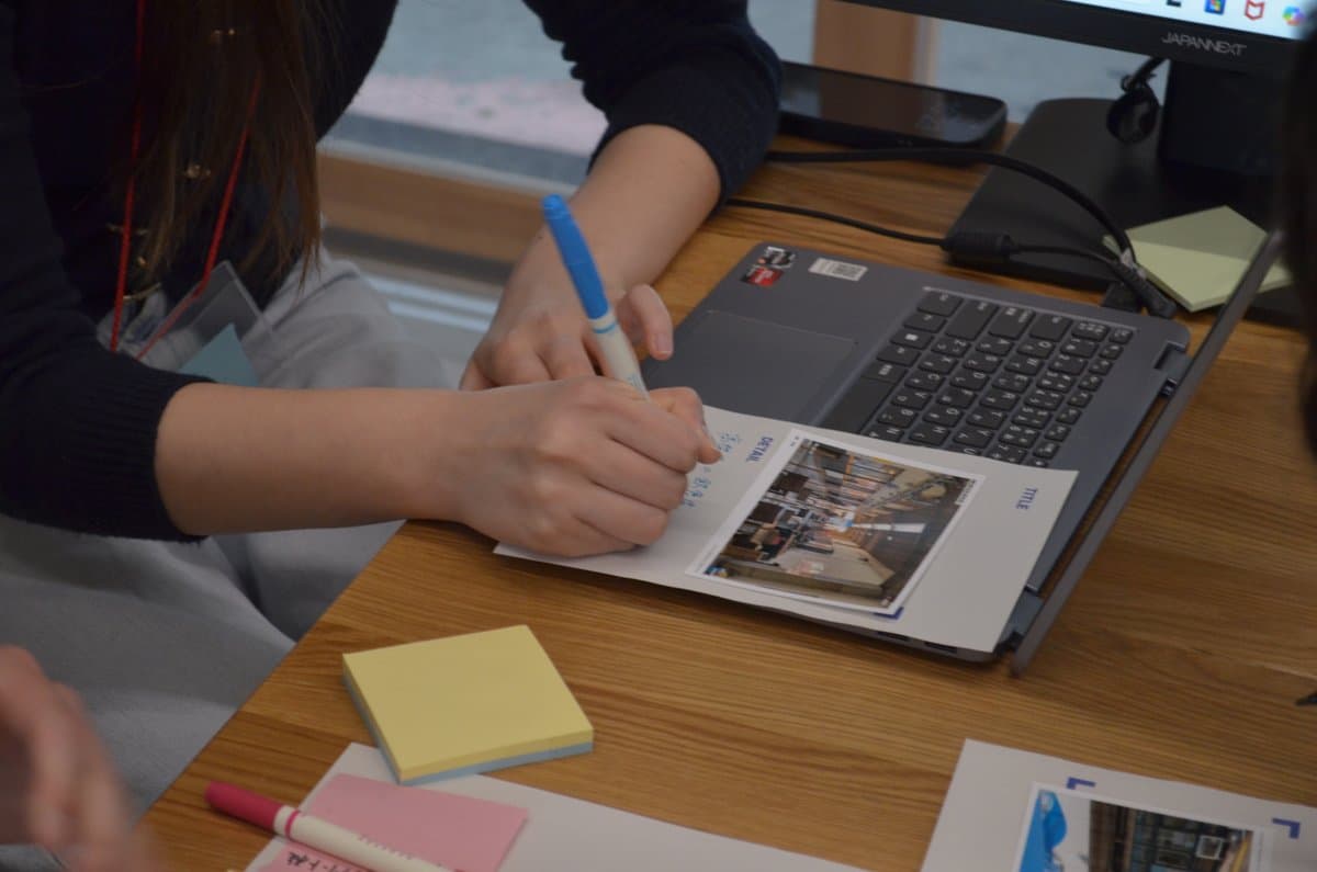
FIG.27
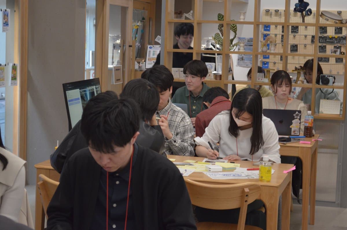
FIG.28
We posted the worksheets with the proposals on the wall at the front of the venue and reviewed all participants’ proposals. This time, we held a vote where participants selected three proposals they found appealing and placed stickers on them.
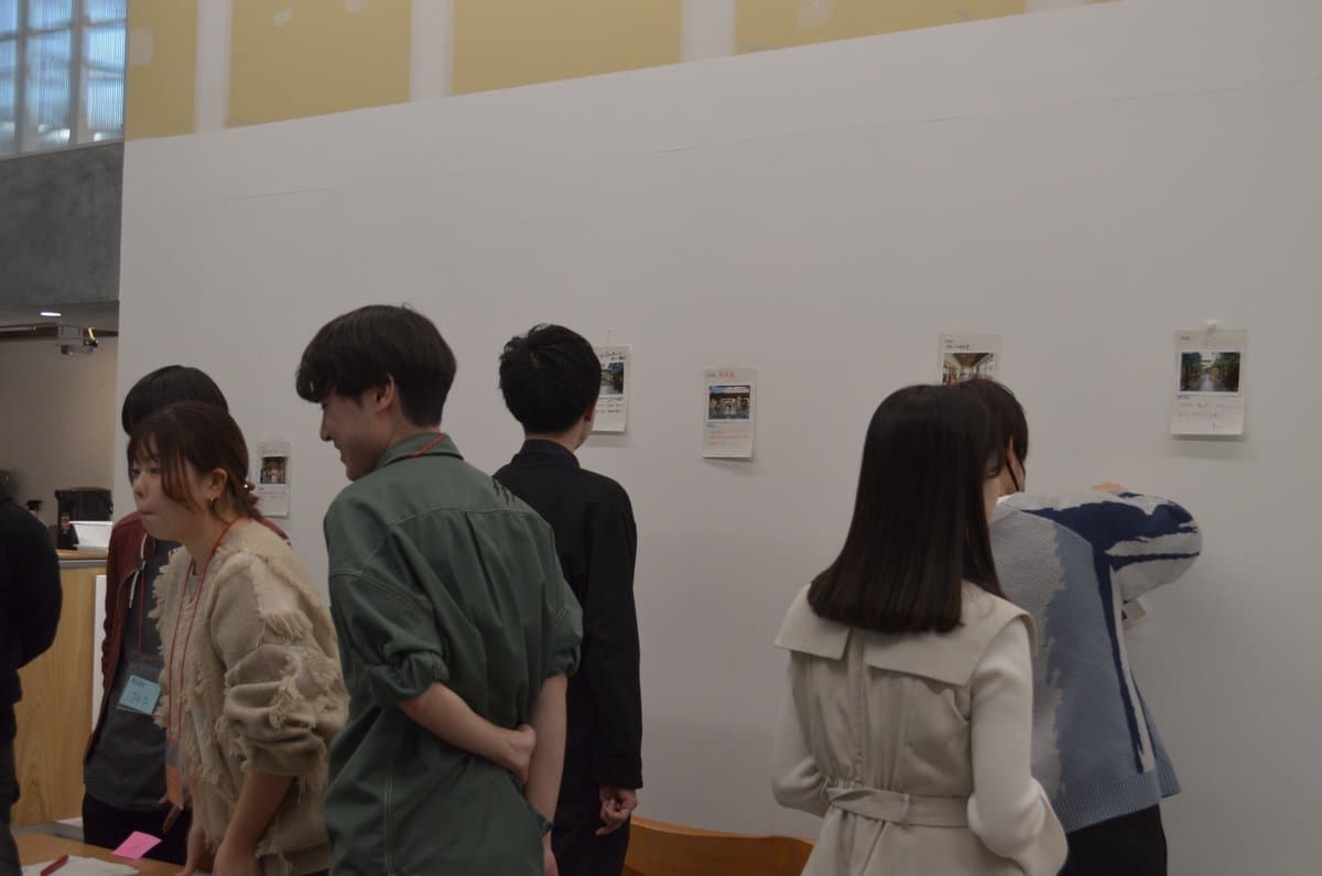
FIG.29
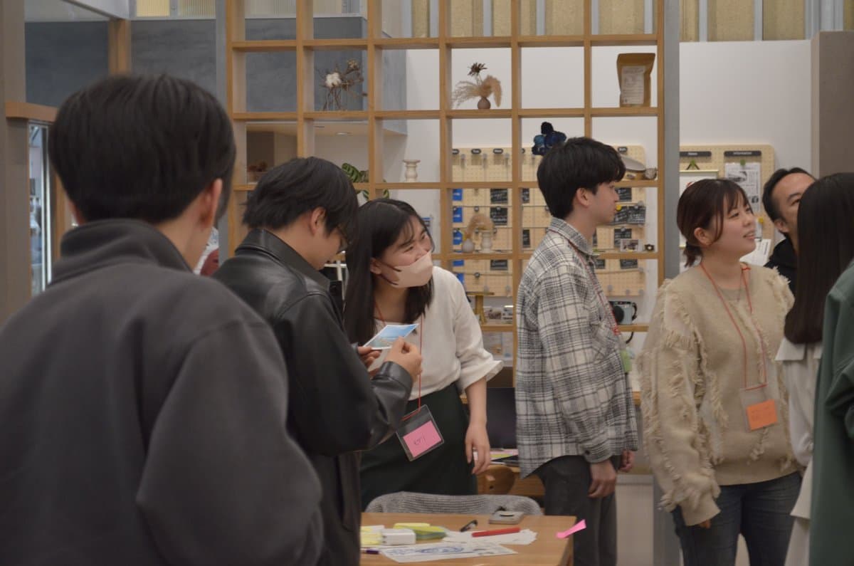
FIG.30
Finally, the creators of the proposals with the most votes were invited to present their ideas. The proposal that received the most stickers was “Guruguru,” a secret base under the elevated tracks. Inspired by the gap between the first-floor shops and the elevated tracks—which evoked images of a “secret base” and a “treehouse”—this proposal uses the pillars, a characteristic feature of the space under the elevated tracks, to create a randomly arranged spatial layout.
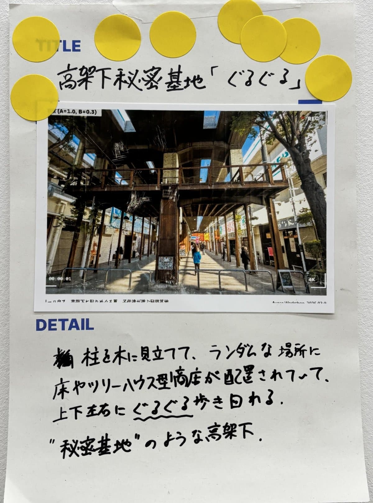
FIG.31
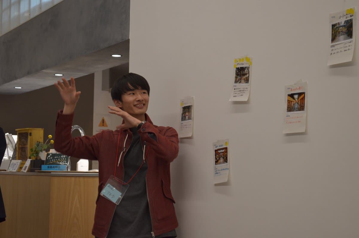
FIG.32
We plan to analyze the images and prompts generated during this workshop to identify the appeal of the West Exit elevated railway area from the perspective of visitors. We will then display these findings for local residents during informational sessions and events related to the neighborhood development plan being promoted by Adachi Ward.
We hope this workshop will serve as the first step toward ensuring that places—not only the area under the Ayase Station West Exit overpass but also other locations that, while lacking special value, contribute to a neighborhood’s unique character—are properly understood and preserved for future generations.
綾瀬駅西口高架下 画像生成AIワークショップ ~この空間に何を視るか~
綾瀬駅西口高架下 画像生成AIワークショップ~この空間に何を視るか~綾瀬駅西口高架下、常磐線と千代田線という2つの大動脈の足下には、綾瀬を象徴するような、どこか懐かしく不思議な雰囲...
Event Overview Date & Time |
March 1, 2026 (Sun) 2:00 PM – 4:30 PM Venue |
Aya Center Guruguru(4-6-34 Ayase, Adachi Ward, Tokyo)
Organizer|ASIBA (General Incorporated Association) In collaboration with|Adachi Ward Community Development Division
Timetable 2:00 PM–2:10 PM Introduction
2:10 PM–2:25 PM Lecture
2:25 PM– 3:00 PM Neighborhood
Walk 3:05–3:15 PM Discussion
3:15–4:00 PM Image Generation Workshop
4:00–4:25 PM Reflection and Presentations
4:25–4:30 PM Closing
Credit
Masaki Morihara, Nozomu Sudo, Taiyo Kawakita
Related Texts
What is the Design of AI that Draws Out Human Creativity?
Tokyo Futurescape Studio Special Interview
INTERVIEW
2025.06.08.
Tokyo Futurescape Studio #02 'Water Road × Community Radio' at Sasahatahatsu Event Report
Tokyo Futurescape Studio Event Report #2
REPORT
2025.08.26.
Special Interview: Essential Skills in the AI Era, What is Rapid Prototyping? - Interview with Mr. Nakajo - | ASIBA
Living Lens Special Interview #2
INTERVIEW
2025.10.07.
A Social Experiment Imagining the Future of Nakano Station South Plaza with Generative AI
Generative AI Social Experiment #2
REPORT
2026.06.10.